Duration: 3 hours
Length: 8.5 km
Difficulty Level: Medium
Suitable for strollers and wheelchairs: No
Parking:
Hasle: Parking at Hasle Marina
Vang: Parking in the center of Vang
Toilets: Available in Hasle, Helligpeder, Teglkås, Vang
Water Access: Available at public toilets in Hasle, Helligpeder, Teglkås, Vang
Surface: Asphalt roads, gravel paths, forest trails, and rocky paths
Special Remarks: The route offers spectacular views of the Baltic Sea, idyllic fishing villages, and unique natural landscapes. Be prepared for steep climbs, especially around Jons Kapel.
The route from Hasle to Vang is one of the most scenic yet challenging trails on Bornholm. The path offers incredible views of the Baltic Sea, small fishing ports, and unique rock formations.
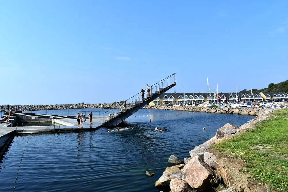
Hasle Marina: The route begins at the marina in Hasle, where you can admire colorful boats and a unique floating swimming pool. This structure is perfectly integrated into the port landscape and offers splendid views of the sea. It is also a great spot to watch sunsets.

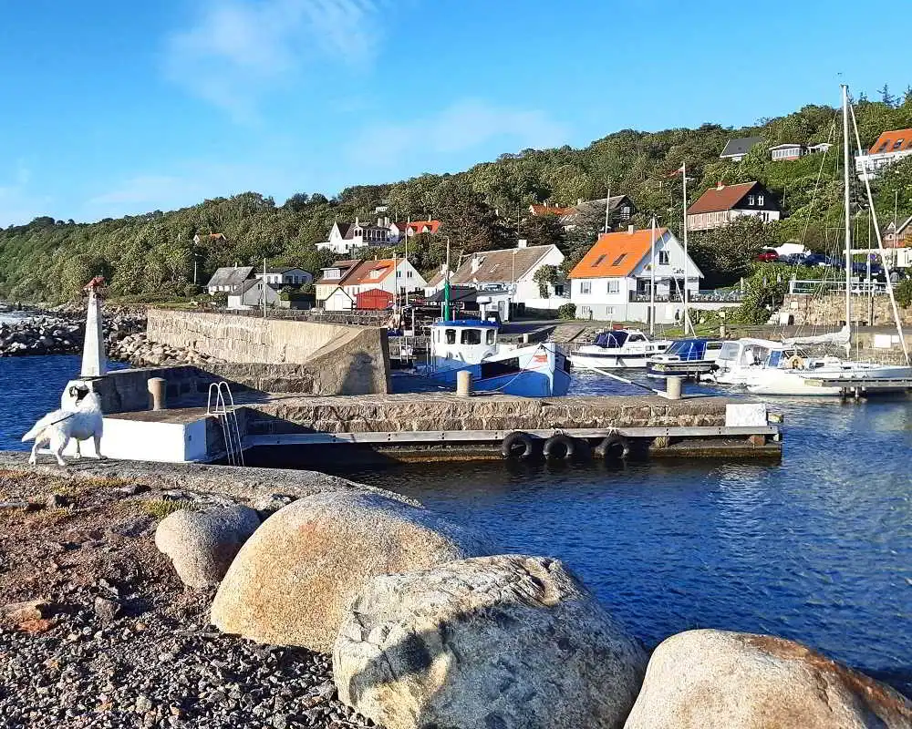
Helligpeder: Continuing on, the trail leads through Helligpeder, a charming small fishing port with picturesque cottages. It's a place where time seems to slow down, making it perfect for a short break at the tables and benches in the port to enjoy the tranquility and local delicacies.
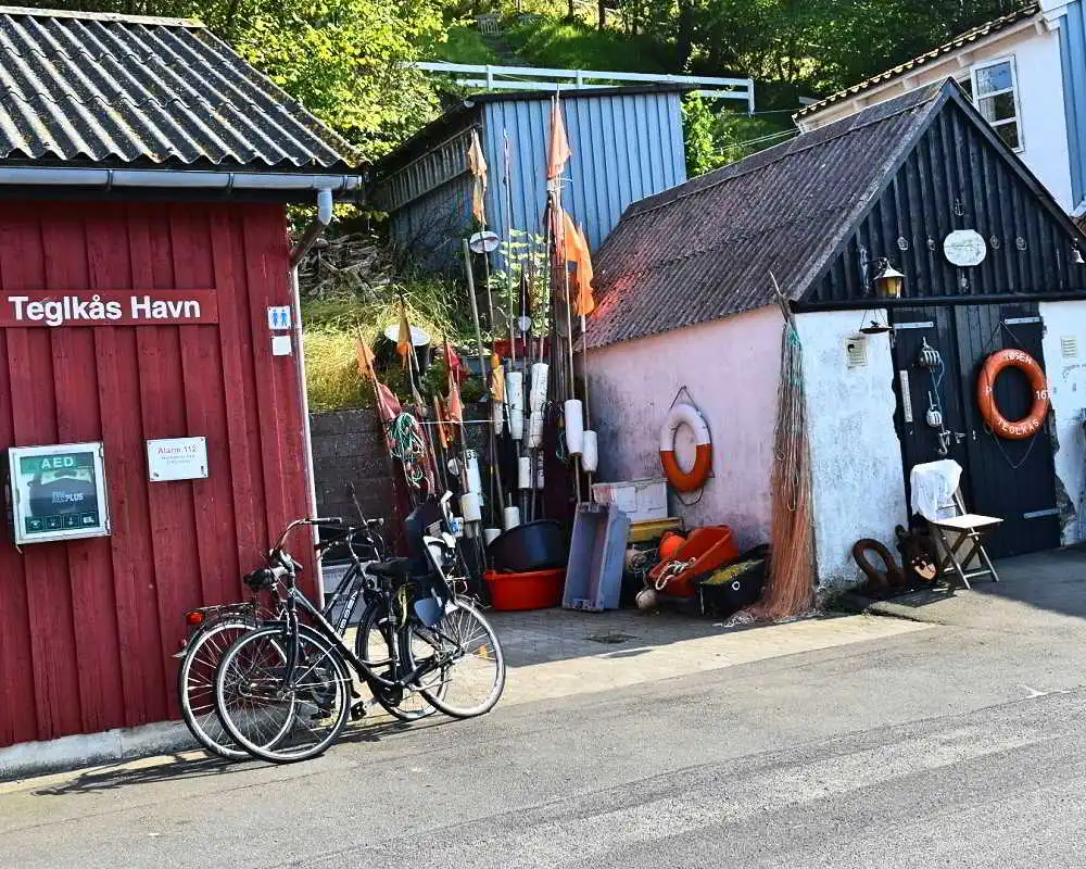
Teglkås: Another fishing port, Teglkås, captivates with its small harbor and idyllic fishing cottages. Teglkås is a place that served as the backdrop for a German TV movie. Continuing the journey, the trail leads through the scenic coastline to Gines Minde.

Jons Kapel: One of the most spectacular points on the route is Jons Kapel, a 40-meter rock formation. Legend has it that the monk Jon converted the pagan Bornholmers to Christianity here. To reach this mystical place, you must descend 108 steep steps, but the views are worth it.

Vang Quarry: This area now serves as a recreational site, offering bike trails and rock climbing spots. Walking along the old granite quarries, you can admire incredible views and discover the richness of local flora and fauna.

Vang Watermill: The watermill in Vang is one of the few preserved examples of traditional milling technology on Bornholm. This historic mill, set in a picturesque landscape, was once a key element of the local economy. Today, it serves as a fascinating tourist attraction.
Vang: The port of Vang, situated on a steep coastal slope, is the last stop on the route. This charming small fishing village has retained its traditional character with narrow streets, stone houses, and views of the Baltic Sea. It's worth visiting the artistic bridge by Peter Bonnén, which leads over a ravine to the quarry, as well as Pissebækken, the highest waterfall in Denmark.

The route from Hasle to Vang offers unforgettable views, historical attractions, and the opportunity to immerse yourself in the local culture of Bornholm. From the bustling marina in Hasle, through picturesque fishing ports, to the charming port of Vang, this trail has much to offer to every adventurer and lover of beautiful landscapes. Prepare to discover the most beautiful corners of the island and enjoy every moment of this unique hike.
Preparation: Choose comfortable shoes and weather-appropriate clothing. The trail can be demanding, so proper preparation is key to comfort.
Supplies: Bring enough water and snacks. There are places along the route where you can rest and eat, but it's better to be prepared.
Map: Although the trail is well-marked, having a map can help with orientation and ensure you don't miss any attractions.
The walking route from Hasle to Vang takes approximately 3 hours.
The length of the route is about 8.5 km.
The route is of medium difficulty.
No, the route is not suitable for strollers or wheelchairs due to uneven terrain and narrow paths.
You can park at the marina parking lot in Hasle or in the center of Vang.
Yes, toilets are available in Hasle, Helligpeder, Teglkås, and Vang.
Yes, access to water is possible at public toilets in Hasle, Helligpeder, Teglkås, and Vang.
Hasle Marina: A bustling port with a unique floating pool and beautiful views of the Baltic Sea.
Helligpeder: A charming small fishing village with picturesque cottages and a peaceful harbor.
Teglkås: Another picturesque fishing village that served as the backdrop for a German TV movie.
Jons Kapel: A spectacular 40-meter rock formation with legendary stairs leading to its base.
Vang Quarry: A recreational area with bike trails and rock climbing spots.
Vang Watermill: A traditional watermill in Vang, one of the few preserved examples of traditional milling technology on Bornholm.
The route surface includes asphalt roads, gravel paths, forest trails, and rocky paths.
Visit Bornholm
Website: visitbornholm.com
Phone: +45 53 33 72 33
Email: contact@visitbornholm.com