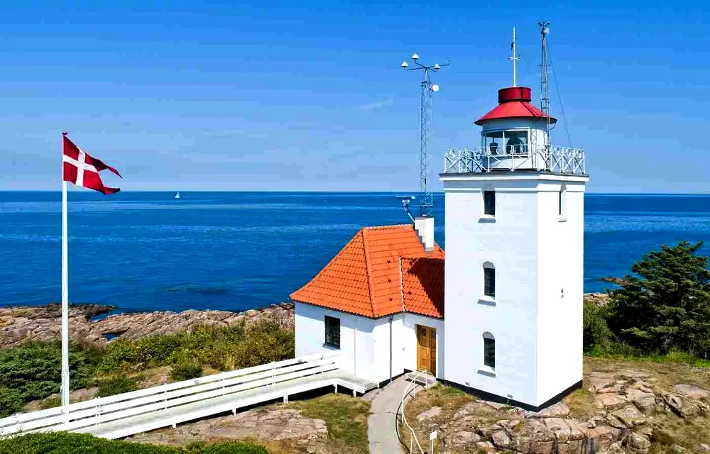
Hammerodde Fyr
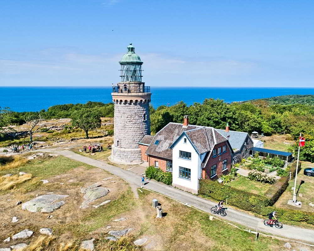
The lighthouse on the northern tip (Hammerodde) – a classic viewpoint and a symbol of this part of the island. The approach starts on a broad path marked in blue.
Hammerknuden • North Bornholm • loop ~9 km • ~2 hours • cliffs, lighthouses, lakes
The Hammerknuden (Hammeren) loop is one of Bornholm’s most scenic hikes. The route is about 9 km (depending on the variant) and usually takes around 2 hours. Along the way you’ll pass Hammerodde Fyr, the ruins of Solomon’s Chapel, rugged coastal sections, and the area around Opalsø and Hammersø. Below you’ll find a Komoot map, a QR code for a quick start, practical tips, and photo cards with key highlights.
Distance: ~9 km (loop / variants)
Time: ~2 hours (without long breaks)
Start: large parking area in Sandvig (most convenient starting point)
Difficulty: moderate – rocky, uneven terrain with a few steep parts
Stroller / wheelchair friendly: no (rocks, steps, narrow paths)
Surface: asphalt (at the beginning), nature trails, rock, gravel
Toilets: by the Sandvig parking area (most reliable option)
Most people start from the Sandvig parking area and follow the blue markers towards Hammerodde Fyr. After the lighthouse you’ll find narrower, rockier sections close to the water. Take extra care in wind and on wet stones.
Tip: in Komoot you can enable navigation and save the route for offline use.
Quick start on your phone
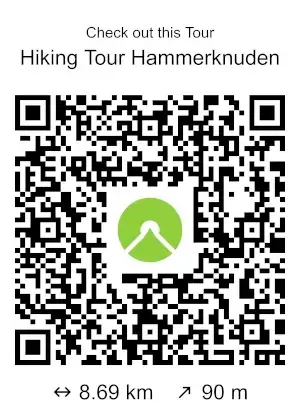
Scan the QR code to instantly open the route in the Komoot app.
Here are the main stops on the loop – each as a photo card. It’s a great plan if you want to hike at an easy pace with short breaks for views.
The lighthouse on the northern tip (Hammerodde) – a classic viewpoint and a symbol of this part of the island. The approach starts on a broad path marked in blue.

Atmospheric ruins with a sense of history – a small stop with a big impact, especially in late-day light.
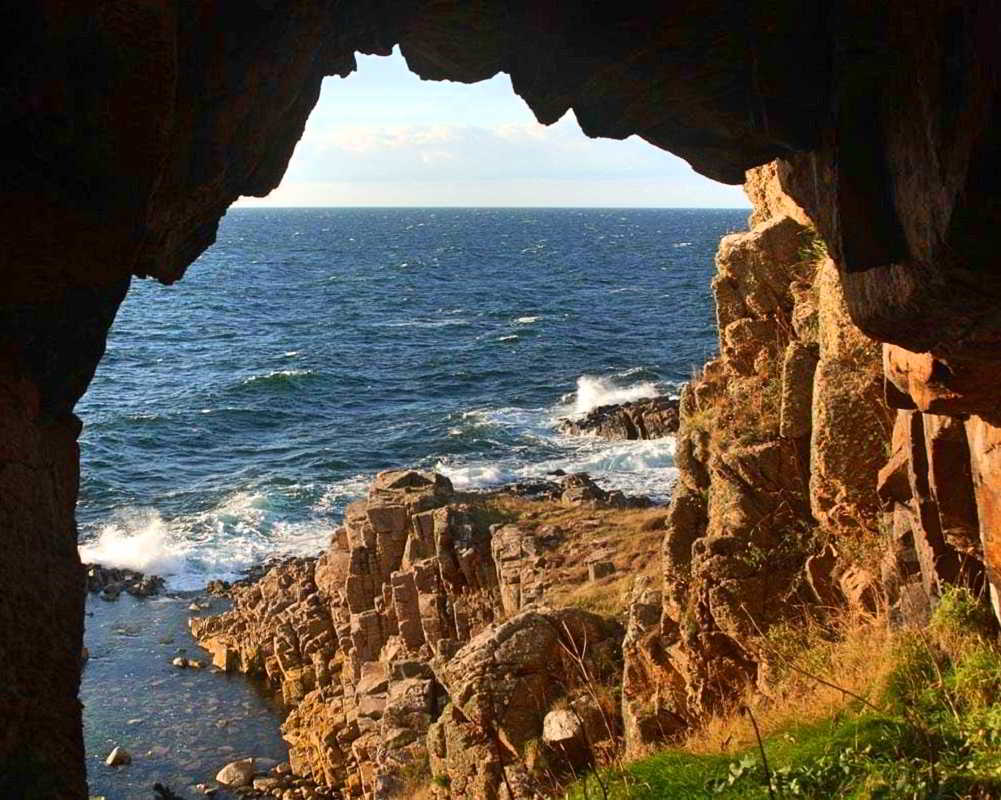
Narrower, rocky passages close to the water – the most “technical” section of the hike. Take care in wind and after rain.
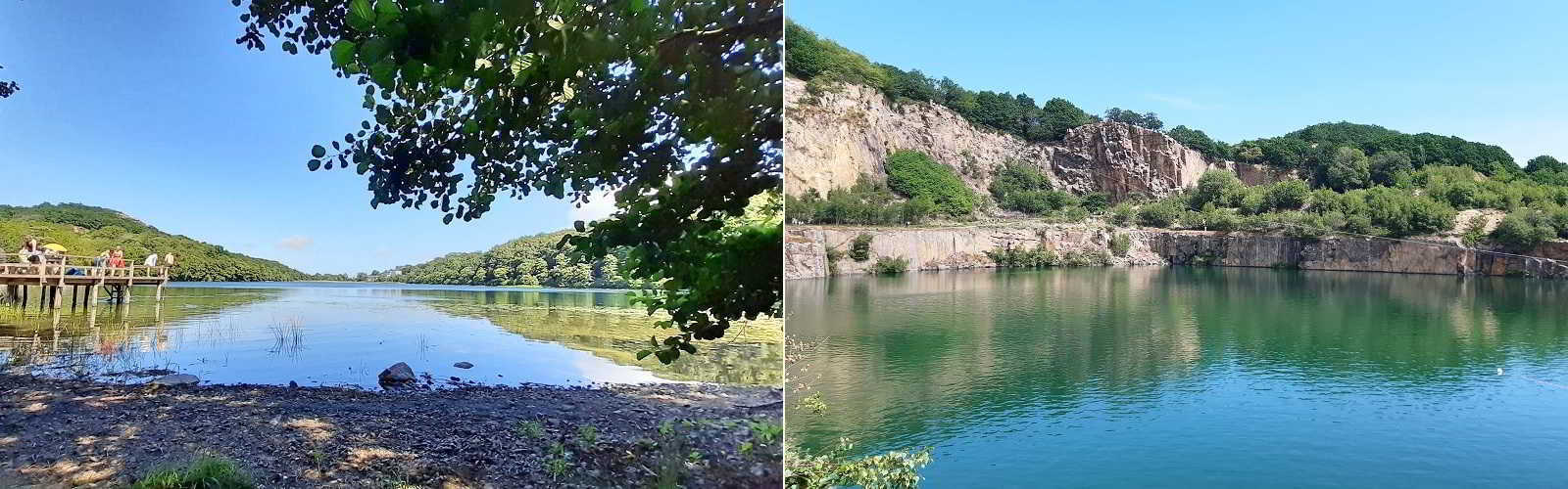
The lakes around Hammerknuden are a beautiful contrast to the rugged cliffs. The return by Hammersø is calmer and more sheltered.
Another strong viewpoint in the Hammeren area – worth the detour if you want to make the most of North Bornholm.
This is not a promenade walk – expect rocks, narrow paths and uneven footing. Wear shoes with good grip and be extra careful on wet stones.
North Bornholm can be windy. Dress in layers and bring a windproof jacket – even in summer.
Bring your own water (there are no “reliable” drinking-water points on the loop). Plan your start/finish around the Sandvig parking area.
Parts of the loop are demanding (rocks, uneven trails and short steep sections). With basic fitness and proper shoes it’s doable, but take it slow and steady.
Spring and summer are the easiest. Autumn offers great light and fewer people. In winter it can be slippery and very windy, so extra caution is needed.
It’s best to bring your own water, especially on warm days. There are no reliable drinking-water points on the loop.
No – due to rocks, steps, narrow paths and uneven terrain.
The easiest option is the large parking area in Sandvig – it’s a popular start point and usually the best place to find toilets.
Want to combine Hammerknuden with Hammershus or create a full “North Bornholm day” itinerary? Message us – we’ll suggest the best route and the right order of stops.


