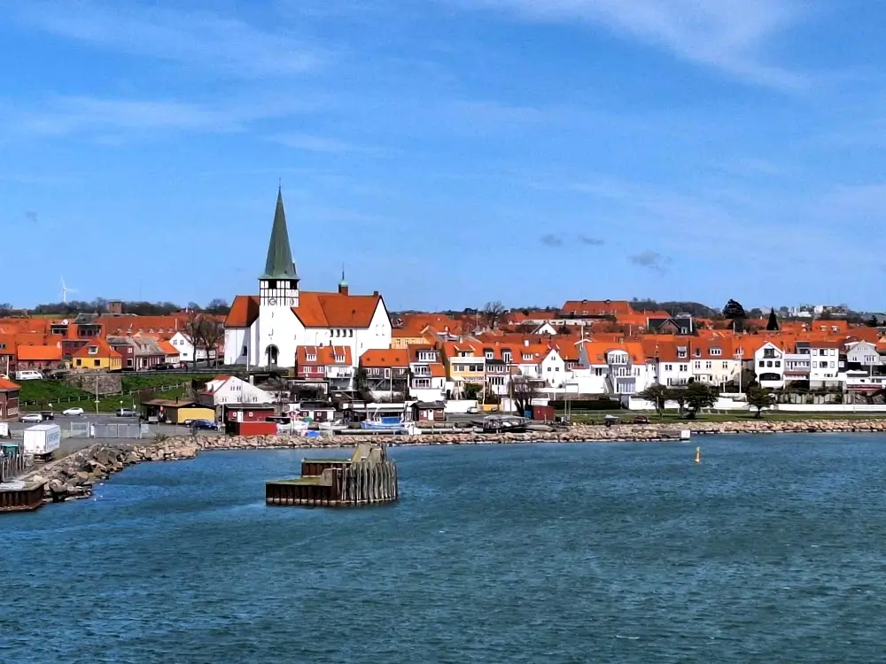
Rønne (start)
Start by the harbour and Bornholm’s Welcome Centre. If you have time, explore the old streets, the Bagfyr lighthouse, and small local museums.
Rønne • Hasle • Komoot map • approx. 11 km • approx. 3 hours • Kyststien, beaches & Kultippen
The Rønne – Hasle section (approx. 11 km, approx. 3 hours) is one of the most enjoyable walks on Bornholm’s west coast. Along the way you’ll pass Antoinette Beach, forest stretches in Blykobbe Plantage, the lake Pyritsøen, and the striking landscape of Kultippen. Below you’ll find a Komoot map, a QR code for quick start, and photo cards with the best stops.
Tip: In Komoot you can enable navigation and save the route offline. The link opens in a new window.
Quick start on your phone

Scan the QR code to open the route quickly in the Komoot app.
Duration: approx. 3 hours
Distance: approx. 11 km
Difficulty: easy to Antoinette Beach, moderate to Pyritsøen, easy to Hasle
Suitable for strollers / wheelchairs: no (natural surfaces, beach and narrow paths)
Surface: asphalt (start in Rønne), then mostly forest tracks, beach and nature paths
Toilets: Rønne harbour, Antoinette Beach, Hasle
Water: public toilets in Rønne, Antoinette, Hasle
Parking: Rønne (Bornholm’s Welcome Centre / Bornholms Velkomstcenter), Hasle (by Hasle Røgeri)
Note: Kultippen is one of the most distinctive landscapes on the west coast. The beaches Antoinette and Klympen before Hasle are great for a short break and a swim (in season).
Here are the key highlights along the walk – each as a photo card. Perfect if you want to take it slow and add short breaks.
Start by the harbour and Bornholm’s Welcome Centre. If you have time, explore the old streets, the Bagfyr lighthouse, and small local museums.
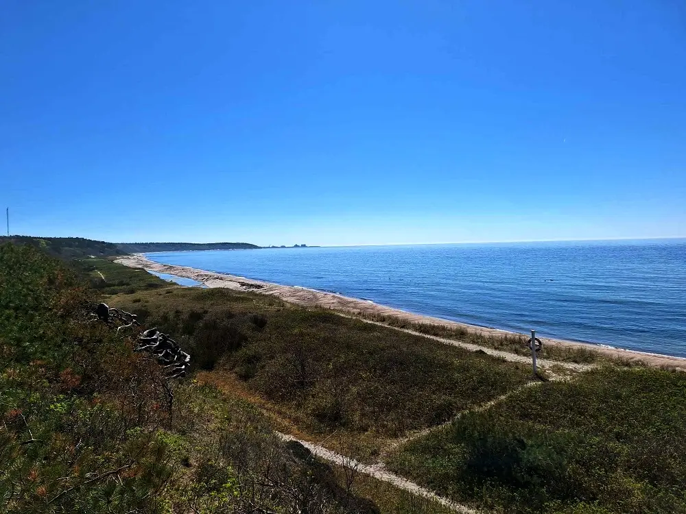
After about 2.5 km you’ll reach a popular beach – great for a break. In season it’s lovely for a swim, and there are toilets nearby.
A forest stretch running parallel to the coast. The shade and calm pace make it especially pleasant on warmer days.
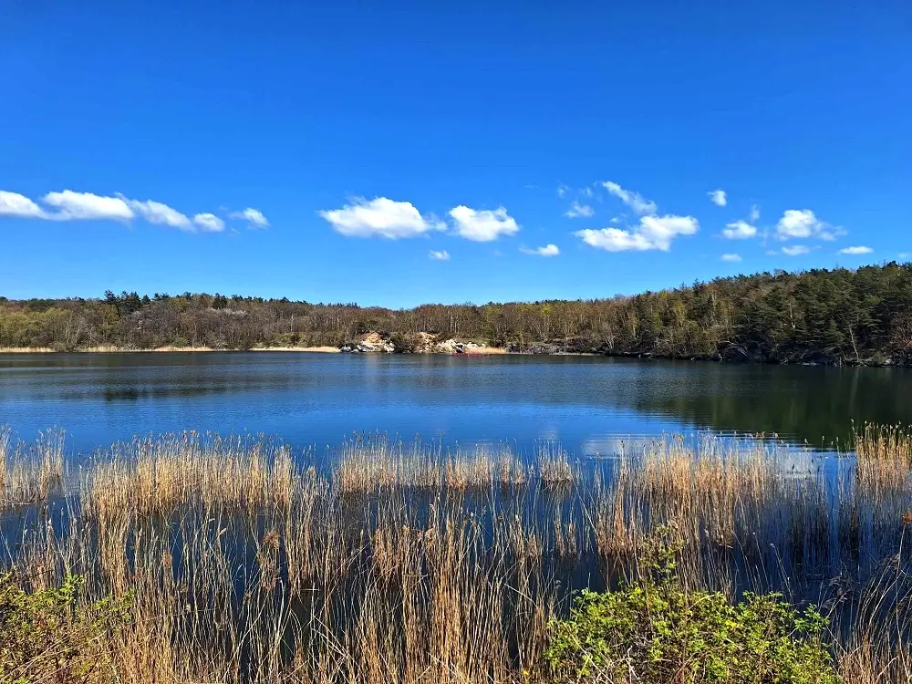
A former clay pit turned into a scenic lake. A short break here is a great reset before the next stretches.

A dramatic, “moon-like” landscape – one of the most photogenic spots on this part of Bornholm.
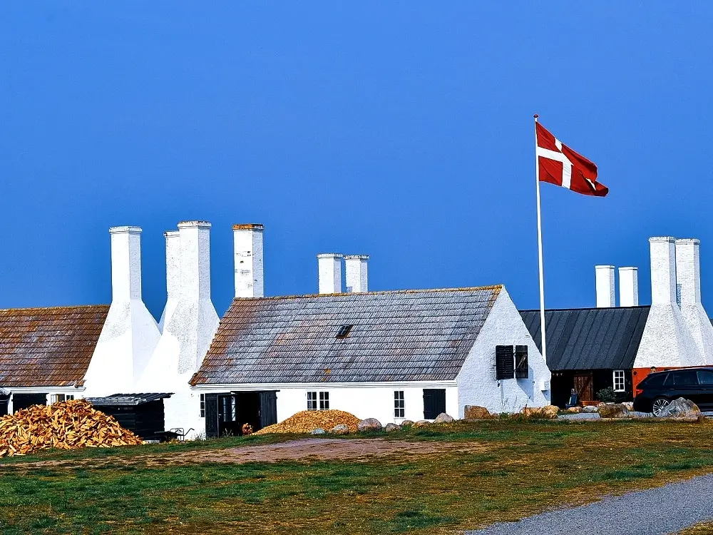
Finish by Hasle Røgeri and the harbour. A perfect place for a break, something to eat, and an easy stroll along the waterfront.
Comfortable shoes, a windproof jacket, water, a snack, SPF, and a light extra layer.
Best breaks: Antoinette Beach and Hasle. Toilets/water: Rønne harbour, Antoinette, Hasle.
Fast on asphalt at the start, then forest and beach sections. Keep extra time for Kultippen and photos.
About 3 hours at an easy pace (not including longer breaks).
Approximately 11 km.
Easy to Antoinette Beach, partly moderate to Pyritsøen, then mostly easy again to Hasle.
No – due to natural surfaces, beach sections, and narrow/uneven paths.
Rønne: parking by Bornholm’s Welcome Centre (Bornholms Velkomstcenter).
Hasle: parking by Hasle Røgeri.
Yes. Toilets and water access are available in Rønne harbour, at Antoinette Beach, and in Hasle.
Rønne (harbour), Antoinette Beach, Blykobbe Plantage, Pyritsøen, Kultippen, and Hasle (Hasle Røgeri and harbour).
Asphalt at the start in Rønne, then mostly forest tracks, beach sections, and nature paths.
Want to connect this walk with other Kyststien sections or add more time in Hasle? Message us – we’ll help tailor a plan to your dates and travel style.


