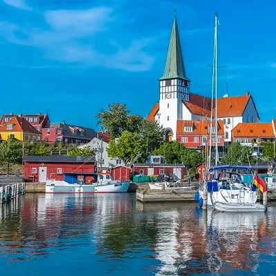
Rønne (start)
Bornholm’s main town: harbour, charming streets and a great starting point along the west coast.
Rønne • Allinge • Komoot map • approx. 26.5 km • west coast and northern cliffs
The Rønne – Allinge cycle route (approx. 26.5 km) follows Bornholm’s west coast northwards. Along the way you’ll pass harbours, scenic stretches, Jons Kapel, small fishing settlements and the Hammershus area. Below you’ll find a Komoot map, a QR code for a quick start and a list of the best stops along the way.
Tip: in Komoot you can enable navigation and save the route offline. The link opens in a new window.
Quick start on your phone
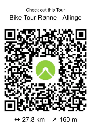
Scan the QR to quickly open the route in the Komoot app.
Here are the best places to stop on the route – each as a photo card. Click the image to open the place page on VisitBornholm.com.
Bornholm’s main town: harbour, charming streets and a great starting point along the west coast.

A harbour town on the west coast. A good stop for a break and a calm stroll along the waterfront.

Charming small fishing harbours between Hasle and the island’s north. Perfect for a short stop and photos.
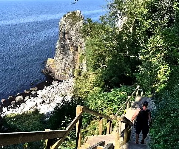
A legendary rock formation on the west coast. A short walk and great views make for a perfect break.

Bornholm’s iconic castle ruins and one of the strongest viewpoints in the north of the island.

The island’s north: harbour vibes and a great base for continuing towards Hammeren.
Windproof jacket, water, a snack, sunglasses, SPF and a thin extra layer “just in case”.
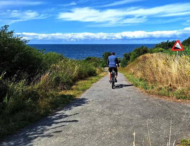
The west coast can be windy – layered clothing and a bit of extra time make a big difference.
Plan a stop every 60–90 minutes (Hasle, small harbours, Jons Kapel, the Hammershus area). This stretch is perfect for an easy pace and photos.
Technically it’s easy, but it’s a scenic route – you’ll often ride slower because there are many great places to stop (harbours, viewpoints, Jons Kapel, the Hammershus area).
From half a day to a full day – depending on your pace and how many stops you make.
Yes – an e-bike is a great option, especially when it’s windy. Assistance makes it easier to keep a steady pace between stops.
Yes – it’s easy to take breaks in Hasle and Allinge, and along the route you’ll find small harbours and viewpoints. For longer stretches, carry water and a snack.
Need a bike for one day or longer? Use our online rental – fast booking and an easy start to exploring.
Tip: in high season, book your bike earlier – it’s easier to match the right type and dates.
Message us – we’ll suggest a day plan, a family-friendly option or how to combine it with other stages.


